|
Ready for a full day of history and adventure? The Law West of the Pecos Loop is a great way to spend a day learning about the "Old West" and to visit icons of Texas as well as a campsite that has been in use for 8,000 years! |
This trip of approximately 250 miles can be taken in either direction as it begins and ends in Ozona, TX. The directions below are arranged so the loop is driven in a clockwise direction. Finding fuel in West Texas can be an adventure, so be sure to confirm availability.
Recommended for Fall, Winter, and Spring Seasons
On the itinerary:
- The Ghost Town of Juno
- Comstock and the Historic US Highway 90
- The Seminole Canyon State Park & Historic Site including the Fate Bell Shelter
- The Pecos River Highway Bridge
- Langtry and the Judge Roy Bean Visitor Center
- The Ghost Town of Dryden
- Drive the Old Spanish Trail, Historic State Highway 290, from Sheffield across Pecos River
- Visit the Fort Lancaster State Historical Site
- Lancaster Hill Scenic Overview
Reminders:
- There are few fuel stations or convenience stores along this route, so make sure you have a full tank of gas, some fresh drinking water and snacks.
- These roads can be blocked by flash flooding, so be aware of the weather conditions.
- If you find yourself in a flash flood, do not drive into water. Your car may stall in as little as 6 inches of water and can easily be washed downstream in the swift current. Don't Drown, Turn Around! Head for higher ground.
- If caught between flooded crossings, remember the flash floods pass quickly. Be patient, the waters will recede soon.
- This itinerary has many activities, so an early start is recommended.
Driving directions from Ozona:
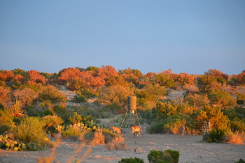
- Drive south on State Highway 163 for 42 miles to the ghosttown of Juno. If you would like to learn more about this community, visit The Ghost Town of Juno page.
- Continue south on SH 163 for another 40 miles to the small town of Comstock.
- Turn west (right) onto US Highway 90
- Drive about 10 miles west on US 90. The entrance to the Seminole Canyon State Park & Historic Site will be on the south (left) side of the highway.
- Visit the park grounds and historical exhibits, maybe even take the guided tour to the Fate Bell Shelter to view the pictographs. For more information about the park, tours, facilities and fees, visit the Texas Parks and Wildlife page for Seminole Canyon State Park and Historic Site.
- When exiting the park, turn west (left) on US 90 and drive about 1 mile.
- The entrance to the Amistad National Recreational Area - Pecos River (Park 67 Road) will be on the south (left) side of the highway.
- Turn south (left) and follow this road for approximately 1.5 miles. It will wind down to observation points overlooking the junction of the Rio Grande with the Pecos River. You will also find a rest area, picnic tables, observation points along the Pecos River banks and a boat ramp. The steep cliff walls visible on the opposite side of the Rio Grande River to the south are in Mexico.
- After stopping for a break and photos, return back to US 90 and turn west (left) back onto the highway.
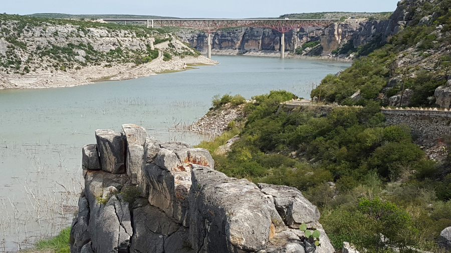
- In less than 100 yards, there is another unmarked turn to the south which leads to a scenic observation point much closer to the Pecos River Highway Bridge, where you will see a breathtaking side view of the bridge. There is a small picnic area with three tables at this observation point. Take a few moments for some more photos and pause to read the historical markers. For more information about this site, visit our Pecos River Highway Bridge page.
- Return back to US 90 and turn west (left)
- Continue west on US 90 for 17 miles toward the town of Langtry.
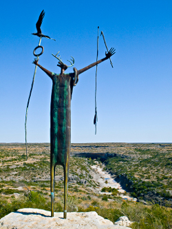
- Take Loop 25 south to visit the Judge Roy Bean Visitor Center. This short loop is a little over a mile long and will take you through the center of what is left of the town of Langtry. Please visit our Judge Roy Bean - Law West of the Pecos page to learn more about this colorful character.
- After leaving the Visitor Center, continue west on Loop 25 back to where it joins US 90.
- Turn west (left) on US 90 and drive 41 miles across the rugged and dry landscape to the Ghost Town of Dryden.
- At Dryden, turn north (right) onto State Highway 349.
- Continue north on SH 349 for 59 miles, one of the most remote paved highways in Texas carrying only about 120 vehicles per day. The scenery will vary from flat desert plains to following the rims of rough canyons that drain into the Pecos River Valley to the east. This section of the route ends in Sheffield, TX.
- At the intersection of SH 349 with SH 290, turn east (right) on SH 290. This is part of the Old Spanish Trail, one of the oldest paved routes from Florida to California.
- Continue east on SH 290 for about 4 miles to the historic metal truss bridge over the Pecos River (built in 1932). Stop for pictures, but be careful to watch for traffic because this road is still very active!
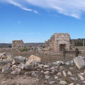
- Continue east on SH 290 for about 6 miles to the Fort Lancaster State Historic Site. Turn north (left) at the entrance to the park. This historic site played an important role in the settlement of a large part of West Texas. It is the only frontier fort in Texas that actually had an Indian battle on the fort grounds.
- When leaving the Fort Lancaster State Historic Site turn east (left) on SH 290 and drive for two miles up Lancaster Hill. The elevation will rise approximately 500 feet. This road carried all the east/west travel through the region until Interstate 10 was finished in the 1980's.
- At the top of Lancaster Hill is a beautiful picnic area on the right side of the highway which offers a commanding view of the Pecos River Valley and the Fort Lancaster State Historical Site. Be sure to stop to read the historical markers and to take pictures.
- Continue north on SH 290 for 9 miles to the intersection with Interstate 10.
- Turn east (right) onto I-10, and drive for 22 miles to return to Ozona.
Thinking about visiting the area?
Learn more about Ozona and Crockett County
when you visit our Tourist Information page.